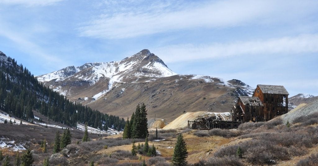
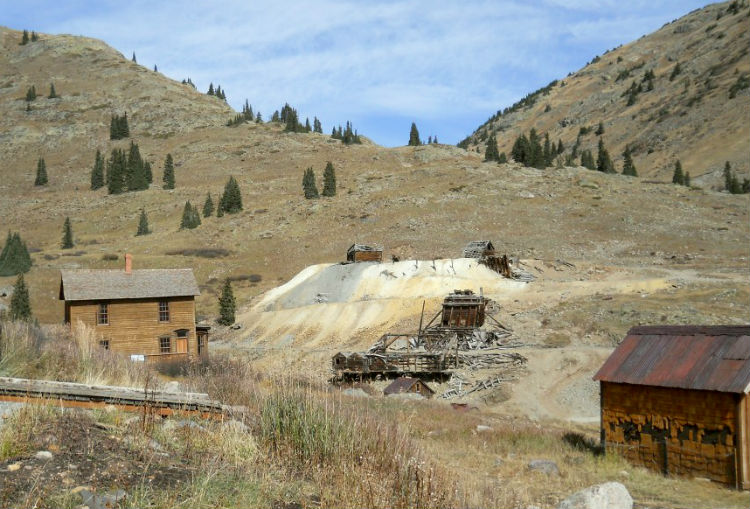
Officially The Alpine Loop Scenic and Historic Byway, there are many sites to see, including Frisco Mill.
Colorado’s Alpine Loop Scenic Byway is a great drive that’s a must for adventurous RVers. In my last few bogs, I wrote about traveling the Million Dollar Highway from Ouray to Silverton. While the Million Dollar Highway is one route that’s worth a visit, part of our journey was taking in the drive off the highway to the Alpine Loop.
If you’re looking to explore this area, turn off at Hwy 550 approximately three miles south of Ouray.* This access point is for 4×4 vehicles only. But, two other roads allow you to proceed in 2WD vehicles. Additionally, nearly two thirds of the byway is primarily dirt. So, even if you don’t have a sturdy 4X4, you can still enjoy the scenery and historic stops.
Although this is not a true loop, it does encompass 63-plus miles of roads between Lake City, Ouray and Silverton. Depending on the winter snow melt, it typically opens in late May or early June. It closes in late October when winter arrives.
You can dry camp along much of the route for those with the right rigs.
Ask locally about road conditions and plan accordingly. The network of roads comprising the loop were carved out of the rugged terrain by miners in the late 1880s, enabling them to transport ore and supplies by wagons. Today, most of the mines are no longer open but the roads still remain open to explore.
If you travel the Alpine Loop Scenic Byway off the 550 early in the season you can admire the wildflowers. When visiting in autumn, you can enjoy the multitude of fall colors. Highlights of the loop also include 12,000-foot Cinnamon and Engineer passes along with the ghost town of Animas Forks. Other abandoned settlements are here as well. If there`s time, RVers shouldn`t pass up Ouray, Colorado.
Dry Camp and Explore The Alpine Loop Scenic Byway
You can dry camp along much of the route if you have the right rigs (i.e. pop up campers on 4×4 trucks or Sportmobile Vans). Allow four to six hours to complete the loop. It takes much longer if you stop to explore. Touring the Alpine Loop Scenic Byway is just another adventure in RVing!
*Those looking to access the northwest leg of the byway off of Hwy 550 will find the turn off at N37° 59.316 W107° 38.981 They will also find a sign alerting them that this is one of the rougher sections of the byway and high clearance four-wheel drive is recommended.

Handies Peak, Redcloud Peak on Cinnamon Pass and Wetterhorn and Uncompahgre on Engineer Pass are worthwhile day hikes along the way. The Uncompahgre Wilderness Area lies west of Lake City and southwest of Gunnison. The Henson Creek Road begins at Second Street in Lake City and leads to Engineer Pass. Nellie Creek Trailhead lies a five miles west of town. Nellie Creek leads north to the broad summit of Uncompahgre Peak (14,309 feet), appearing like a monolith displaced from Monument Valley. A few miles west of Uncompahgre Peak, across a sharp and ragged ridge, 14,015-foot Wetterhorn Peak points skyward. Wetterhorn Peak is commonly ranked as the eighth most difficult ascent among the Fourteeners of Colorado.
Kim I totally agree with your recommendations. I’ve spent several summers in Lake City and know the area well, these are all great places to visit. For RVers I recommend staying in any of the RV parks in Lake City renting a jeep and doing the loop from east to west. Finally, I also suggest that visitors check out Deer Lakes, which are close to Windy Point about 5 miles south of Lake City on Highway 149. These small ponds should be called “Moose Lakes” because you’re guaranteed to see them in the morning and before sundown!