The sign as you turn east off Highway 395 just south of Lee Vining, California states “Narrow Winding Road Next 46 Miles,” but don’t let that discourage you from driving the span of Highway 120. It is mostly RV friendly and full of adventure.
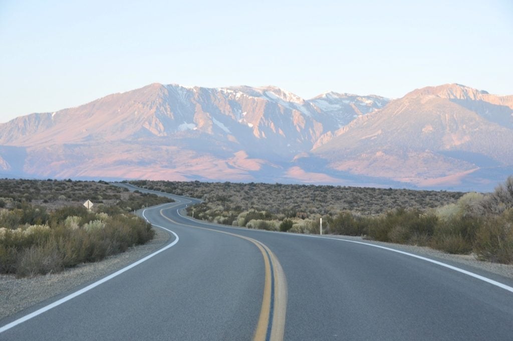
Eastern Sierras
The following is a list of things to see and do as you travel the route listed west to east:
1. Mono Craters
The mono craters are a series of recent volcanic cones that occurred just 650 years ago, making them the youngest mountain range in North America. Panum Crater has developed hiking trails for those who would like to get up close and personal with a volcano.
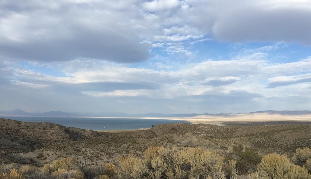
Mono Lake as seen from the highway
2. Mono Lake
Ancient and shrinking, Mono Lake is visible along the western part of the route and famous for its tufa formations.
The largest tufa groves can be found along the south side of the lake via a short gravel road to the South Tufa viewing area.
3. Mono Mills
At Mono Mills, you can view the scant remains and learn the history of the lumber industry that supplied needed building materials to the mining boomtown of Bodie over one hundred years ago.
As you descend out of the pine forests that supplied the hungry saws of Mono Mills you will enter the Adobe Valley. The road is straight and stretches for miles through the scenic valley. While there are no specific sites of interest through this portion of the highway, there are some surprises that RVers will encounter.
For example, while this section contains long straight portions of the road, the engineers must have been fans of rollercoasters as they didn’t spend much time filling the small drainages that run crosswise to the road through most of the valley. Fair warning when you open your RV refrigerator to prepare lunch!
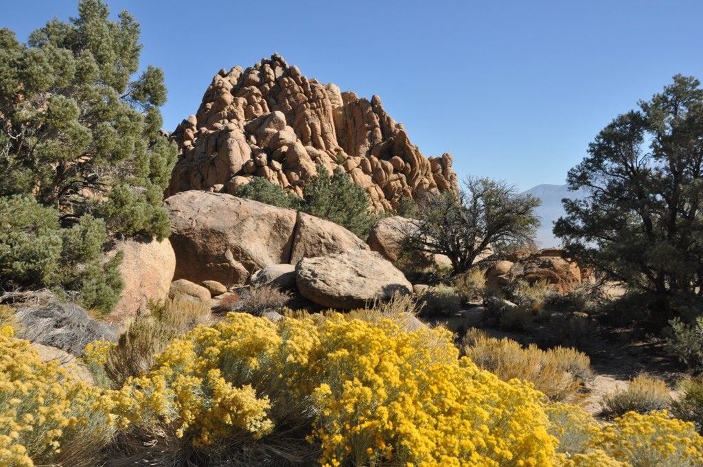
Rock formations
4. Wild horses
The area along Highway 120 is also home to a herd of wild horses, so be on the lookout as you travel.
5. Rock formations
Next, you will climb a small pass over the Benton Range. As you approach the summit you will encounter beautiful rock formations worthy of state or national park status.
There are no pull-outs, so instruct your co-pilot to have their camera ready and proceed with caution.
6. Benton Hot Springs
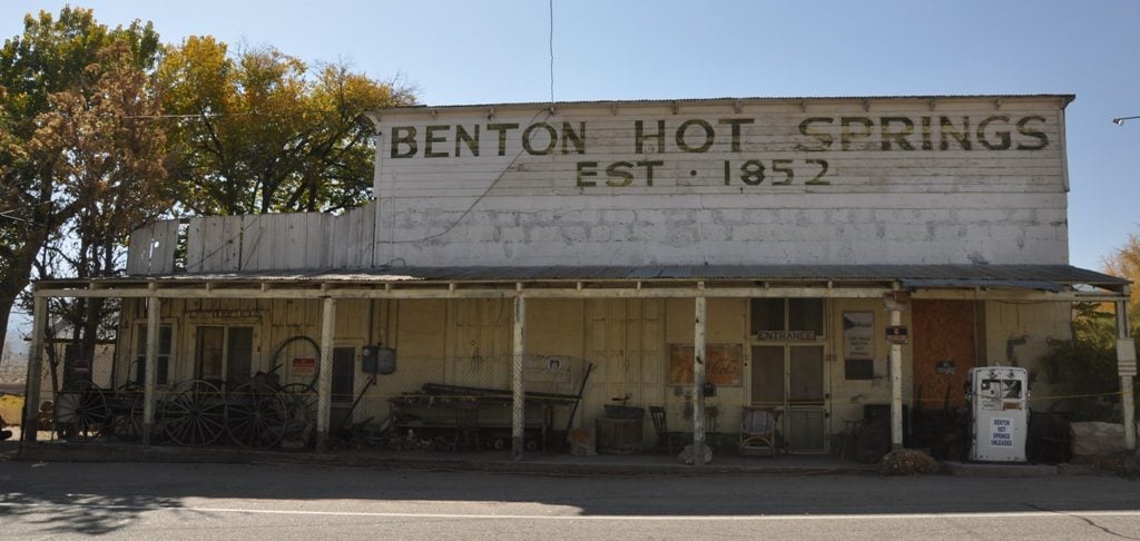
Benton Hot Springs was established in 1852 to support mining in the area. Today it clings to life catering to tourists who come by to soak in the namesake springs.
7. The buildings and relics
There are many photogenic buildings remaining along with rusty vehicles and farming equipment. The ghostliest buildings are located on private property on the southwest outskirts of town and can only be viewed from the highway.
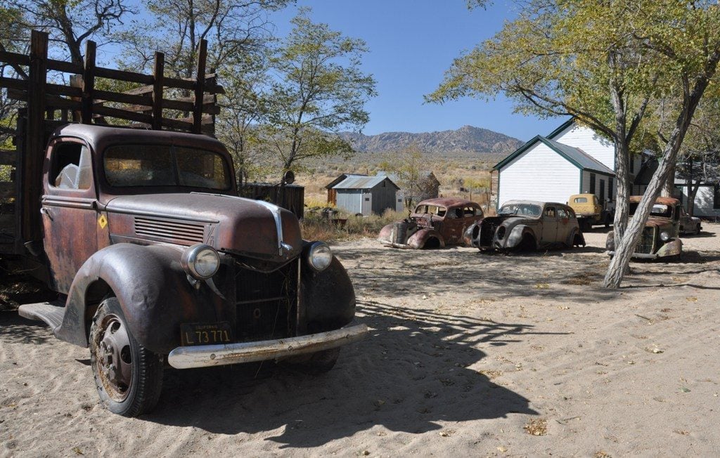
Hot spring relics
Your journey on Highway 120 comes to an end at the town of Benton, where you can obtain fuel and a few other amenities before heading north or south on Highway 6.
The highway is closed in the winter, so plan accordingly.
Where to camp:
Sagehen Meadows Campground is the closest thing to a developed public campground and is located about halfway along the route a mile or so off the highway.
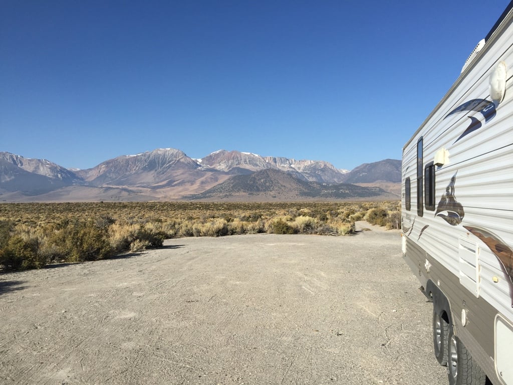
Boondocking near Panum Crater
There is a private campground at the Benton Hot Springs where each RV site contains a private hot tub!
Coordinates for places mentioned:
- Panum Crater turn off: N37° 54.844 W119° 02.797
- South Tufa turn off: N37° 55.587 W119° 01.400
- Mono Mills Interpretive Site: N37° 53.270 W118° 57.630
- Rock Formations – Vicinity of: N37° 47.300 W118° 33.670
- Benton Hot Springs: N37° 48.023 W118° 31.780
So don’t let that narrow and winding road sign keep you from enjoying Highway 120. Other than limited shoulder width and a couple sharp turns, there is nothing for an experienced RVer to worry about.
Seems like including a map of the highway somewhere in the article might be helpful to people.
Tom – Good suggestion. However, signage is sparse along the route making navigating by GPS your best option.
Agreed, I would have liked a map for quick reference. Merry Xmas!
If you need a map, copy and past the above into browser.
N37° 54.844 W119° 02.797 into any browser
https://www.google.com/search?q=N37%C2%B0+54.844+W119%C2%B0+02.797&oq=N37%C2%B0+54.844+W119%C2%B0+02.797&aqs=chrome..69i57.528j0j7
Any of the above can be copy and pasted into any browser.
Coordinates for places mentioned:
Panum Crater turn off: N37° 54.844 W119° 02.797
South Tufa turn off: N37° 55.587 W119° 01.400
Mono Mills Interpretive Site: N37° 53.270 W118° 57.630
Rock Formations – Vicinity of : N37° 47.300 W118° 33.670
Benton Hot Springs: N37° 48.023 W118° 31.780
Thanks for sharing.
Thanks for that useful tip.
Nice suggestions…. my son and I have traveled through there a couple of times and it seems we have missed a few cool things to see. Thanks for sharing!
Highway 120 also includes travel through Yosemite National Park, including Tioga Pass, Tuolumne Meadows, Olmstead Point, and access to Yosemite Valley. I cannot believe these crown jewels of our National Park System were omitted!
If you were to read the first few words in the article it stated ” TURN EAST OFF THE 395″ therefore nothing on the west side of the 395 is mentioned. this is a good article. I have been on the 120 thru Yosemite many times and with a senior citizen pass (62 and older) you can get into all national parks free and camp at half price. I have never traveled the east side of the 120 which makes this article interesting. how far from the 395 is Nevada? now I am curious and am going to review some info on google maps and route my RV Garmin in preparation for a new adventure.
Gregg,
It is approximately 50 miles from Hwy 395 to where north Hwy 6 crosses into Nevada via Hwy 120
I checked it out in google maps, what would you think the best time of year would be to try this little adventure? I was thinking of a loop 5S to 14N to 395N to 120E to the 6N then the 95S to Las Vegas then take the 15S home to the 58N then the 14W to the 5N. I was thinking this would make a nice 3 day maybe 4 day trip , leave on a Friday morning and get home on Monday morning. This way each day we could start a new adventure stopping at all the cool old places along the way. (PICTURE TIME) + (VIDEO TIME) = (FUN TIME) I was kind of thinking middle of spring? while things are in bloom and the snow has melted enough to not hinder the trip, not to hot and not to wet. What would you suggest?
Gregg,
I would think mid-spring or late summer would be good. We did it in mid October and it was a bit cool. Enjoy!
You only get this pass if your an American not if your from any other country or Canada!!!!
I grew up in this area and so I travel there quite often. The 120 dead ends at the 395 about 3 miles south of Lee Vining but it picks up again just outside of town to continue on into Yosemite. If you come up the 395 from the south, leave Bishop on US 6 and the 120 junction is about 35 miles up the road at Benton Station.
The highway is smooth as it was repaved about 2 years ago. The scenery changes rapidly going from rocky hills at Benton to pine forrest near Mono Lake and lots of desert in between. Watch for deer, wild horses, and cattle.
Thanks for sharing. There is a lot of variety in a relatively short section of road.
My rig is total 58 ft with truck Can I make it on this road ?
David,
Not a problem. My combined length is just over 50ft.
Great areas to explore… if you elect to boondock in the hills beware that many of the roads are graded, decomposed granite particles that are like minute ‘marbles’ making traction almost like sand…. Inclines can be problematic…. haha, don’t ask me how I know…!!! Got stuck in our Class C there years ago, & had to dig us out…! I tend to ‘explore’ where many won’t go, however… haha
120 is a fun road too. The road has very sharp rises and dips. On a motorcycle you have to be a bit more careful as you cannot see far enough ahead as you crest a rise. Our daughter called them whoop dee doos. It is possible to full compress the shocks on a car or motorcycle at the bottom of the dip and to lighten the front end at the crests. Just be careful!! Pretty country.
One of our favorite RV parks is “Mono Vista RV” just on north end of Lee Vining. It is shady in summer with clean facilities and easy walking distance into Lee Vining for Ice Cream or BBQ or whatever. We love to camp here and explore the many hiking areas nearby: Mono lake and it’s parts, Tulomne Meadows is nearby as is Bodie and lots more. Probably not great for huge rigs (we have a 19′ Shadow Cruiser 189FBS) and most annoying is they don’t take credit cards (cash or check). Nice grassy areas for tents too if not RVing.
Awesome drive. Easy for any vehicle. It is closed in the winter depending on snow fall. Driven this road 100’s of times over 30 years of living in Mono County. Be on the lookout for wild horses, deer, coyotes and other creatures.
Is 120 negotiable in a 45′ motorcoach with tow vehicle – a total of 70′ or so?