For those exploring the area around Fairbanks, Alaska, White Mountains National Recreation Area offers over a million acres of striking remote arctic scenery, solitude, and sporting that is accessible by road.
Located between the Steese and Elliott Highways north of Fairbanks, “the Whites” is a favorite year-round recreational area for locals. Moose, bear, fox, beaver, martin, and over 184 species of birds call the area home.
Summer visitors can hike the numerous trails, fish in many rivers and creeks, and pan for gold. Fall visitors can enjoy moose hunting (starting September 1) or berry picking (best in mid-August).

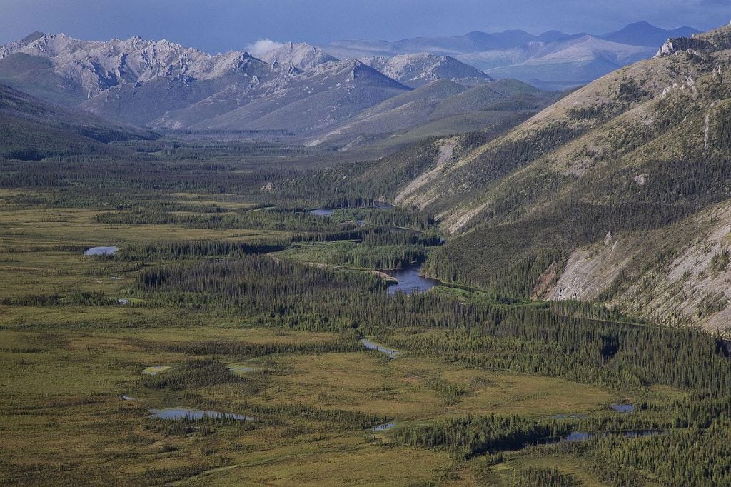
Overlooking the limestone formations of White Mountains National Recreation Area (Photo by Bob Wick)
Winter allows additional access over the frozen terrain, bringing out the skiers, snowmachines, and sled dog teams to enjoy the trails and remote BLM cabins and shelters.
The very adventurous of winter visitors can also have a unique Alaskan experience in the Whites by taking an excursion by dog sled team with the friendly dogs and knowledgeable mushers of the DewClaw Kennels – Alaskan Husky Adventures.
Experiencing travel in this extraordinary fashion allows for a much more meaningful connection with the trail, landscapes, animals, and history of the area.
Beaver Creek is a National Wild River that has its headwaters in the White Mountains and travels through Alaska’s Interior region before joining the Yukon River downstream from the village of Beaver. A Class I (with some Class II) clear water river, visitors can experience the remote wilderness by floating from the launch at Nome Creek Road on the east side of the NRA.
After leaving the Nome Creek launch, there are no roads or services until you reach the Dalton Highway Bridge, 360 river miles downstream. The float trip can take between seven days to three weeks to complete and is considered the longest road-to-road float in North America.
During the Gold Rush era of the late 1800s, fortune seekers came to Alaska to search for gold. A four-mile stretch of Nome Creek is currently designated as a recreational gold panning area where people can still find Alaskan gold as the prospectors did nearly 200 years ago.

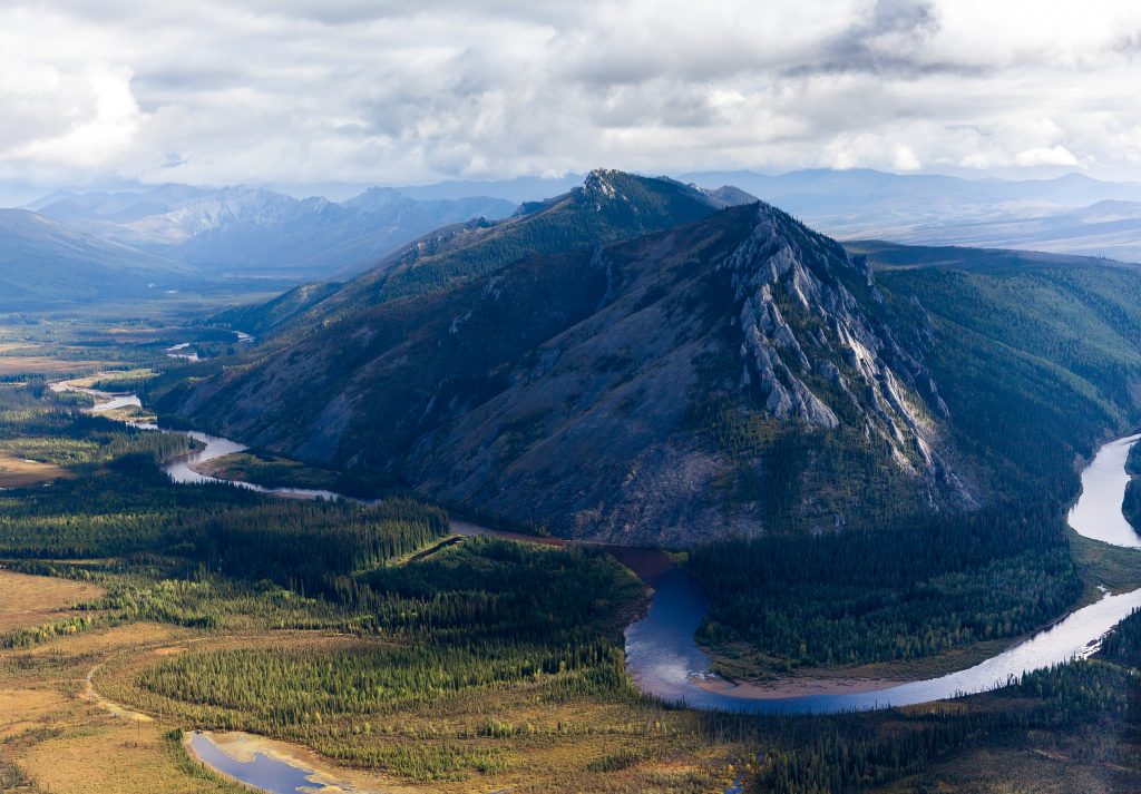
The Big Bend of Beaver Creek in the White Mountain NRA (Photo by Craig McCaa/BLM)
Big Bend on Beaver Creek Wild and Scenic River by Bureau of Land Management Alaska is licensed under CC BY 2.0
Between Nome Creek Bridge and the mouth of Moose Creek, recreational gold panning is permitted but limited to hand tools such as gold pans, rocker boxes, picks, and shovels. Motorized equipment is not allowed.
The remains of the Davidson Ditch, a 90-mile long pipeline that was built in the 1920s to supply water to gold dredges in central Alaska, can also be found in the White Mountains NRA.
This ditch roughly parallels the Steese Highway. The engineers that designed the Trans-Alaska Pipeline in the 1970s used many of the lessons learned from the Davidson Ditch construction in their design.
The Chatanika Lodge is located at Mile 28.5 of the Steese Highway and offers lodging, a restaurant, and a bar for the area. Family owned and operated since 1974, the Chatanika Lodge is a great place to pop in for some history of the area, hot food, friendly service, and an array of fun, quirky events held throughout the year (such as human bowling).
There are three RV accessible primitive campgrounds operated by the BLM that are maintained from June through mid-September. All three campgrounds are recreation fee sites with registration and payment information near the entrances.
They offer hand-pump wells, trash cans, and outhouse-style toilets. Each campsite has a parking area, picnic tables, and fire rings (firewood is not provided). Note that the nearest RV dump station and services are in Fairbanks, so plan ahead. Each campground offers a different experience for visitors.
The Mount Prindle Campground is located on the east end of the Nome Creek Valley. Access is off of the Steese Highway at Mile Marker 56.

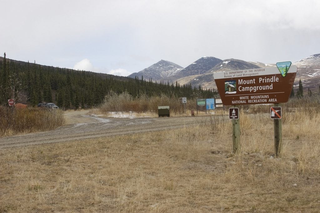
Mount Prindle Campground with Mt. Prindle in the distance (Photo by Craig McCaa/BLM)
The campground’s 13 campsites are situated among tall willow shrubs, below expansive alpine tundra meadows and Mount Prindle (5,286 feet), making it the ideal spot to begin a trip into the high country. From here you can enjoy gold panning in Nome Creek or explore the nearby Quartz Creek Trail.
The Ophir Creek Campground is located on the west end of the Nome Creek Valley. Access is off of the Steese Highway at Mile Marker 56. At Ophir Creek are 20 campsites (including one group site) that are nestled in tall white spruce trees on the bank of Nome Creek.
From here you can enjoy fishing in Nome Creek or take a short day-hike over to Beaver Creek. Nearby is the 3-mile loop trail to Table Top Mountain, with spectacular views of the higher peaks in the White Mountains. Ophir Creek Campground also provides river access to Nome Creek for paddlers headed to Beaver Creek Wild and Scenic River.
The Cripple Creek Campground is located at Mile 60 of the Steese Highway. Although not technically in the White Mountains NRA, the campground provides access to the river and 25-mile long float trips into the nearby Upper Chatanika State Recreation Site.
The Upper Chatanika River State Recreation Site is a state-run recreation area located at Mile 39 of the Steese Highway. Twenty-four RV accessible primitive campsites are available for those wanting to explore the 73 acres of state land closer to Fairbanks.

Leave a Reply