RVing on the Wrong Road is Expensive
The last thing you want in your RV travels is to turn down the wrong road. One bad decision can take you down a dangerous route. Think you’re safe with a car GPS? Maybe not. The basic navigation is not programmed to keep you from going down roads where you won’t fit.
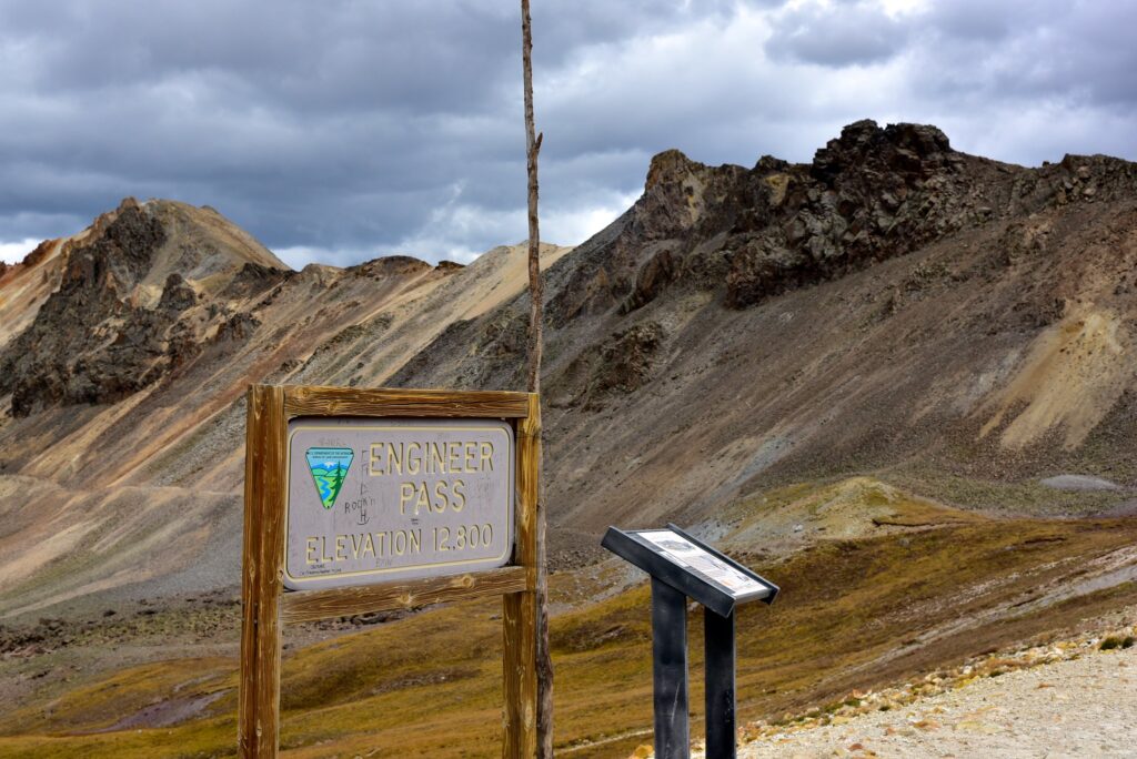
One box truck driver recently learned this the hard way when he tried to take his 30-foot vehicle over Engineer Pass. This is a rugged mountain road in Colorado’s San Juan Mountains. He became stuck near the top of the pass, blindly following his car GPS. The driver did not realize this high mountain pass (sitting at 12,800 feet) is a difficult, narrow road. Usually only 4-wheel drive high clearance vehicles go there.
Engineer Pass is part of the scenic high country Alpine Loop, which connects Silverton to Ouray and Lake City through the San Juan Mountains. For a better idea of this predicament, imagine taking your coach along the road shown in this video:
According to The Durango Herald, the box truck was not completely blocking the road, but making it much more difficult for 4WD vehicles to pass by. The truck operator needed several tow trucks to get his truck out of the way. That bill is going to run him several thousands of dollars.
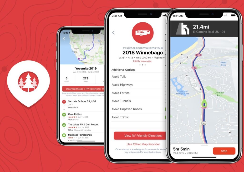
While he was operating a box truck, RVs are no different, considering many RVs are 30 feet and larger. That’s why it’s essential to travel with an RV-specific GPS like RV LIFE Pro to navigate safely based on your vehicle dimensions.
With the RV LIFE App, you can put in your vehicle’s height, length, and weight, as well as fuel information like whether or not you’re carrying propane. This can help you avoid steep mountain roads. And you’ll avoid low clearance bridges, bridge weight limits, and tunnels with propane restrictions. Just like your typical car GPS, the RV GPS will provide you with convenient turn-by-turn directions and lane guidance.
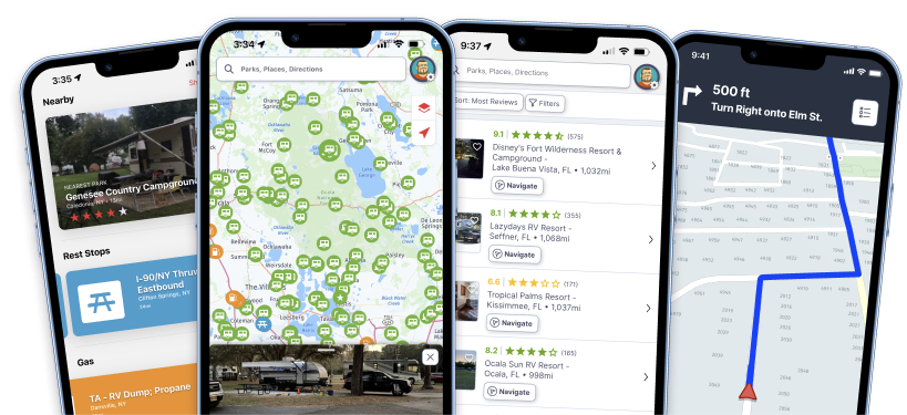
An added bonus with RV GPS is that it makes it even more simple to find campgrounds along the way, as well as other points of interest like fuel stations. With an RV-safe GPS app on your phone, there’s also no need to worry about updating maps as they are kept up-to-date automatically as long as you’re connected to the internet.
To learn more about RV LIFE Pro, check out our article on RV Safe GPS Directions Right From Your Phone.


Oops! 🙂
That video was amazing. Just going up beyond the treeline must’ve been something to witness! 😀
I can’t believe he drove that fast 😳
Until last year we had a 36′ Gulfstream that we took all over the country. We had a Garmin that had both car and RV route capability. It was some of the best money we ever spent and I recommend an RV-specific or dual capability GPS to everyone. I compared RV vs. car routes several times on the Garmin and there weren’t always differences, but there were enough times that it saved our bacon and our pocketbook! I wish the RV Life version had been available. I would have preferred to have my RV GPS on my phone than yet another piece of equipment to carry and keep charged. Updates are easier and color and display are better.
A GPS is an AID, not something to bet your life off! Every summer, there are folks who attempt to tow their trailer over Hwy 242 (McKenzie Highway) in Oregon between Sisters and Hwy 126 going to Eugene. Folks will blindly ignore the “35 foot length limit” sign because the GPS gave them that particular route. Then, they’ll blithely drive by not one but THREE warning signs and sail by the “last chance” turnaround. There are even a few semis who have done this, resulting in a stuck/jackknifed rig, blocking the road…
It’s an AID…and if one checks a paper map, and sees all those “squiggles” on the route, well, that should be a warning sign to seek a better route.
PPPPPPP…”proper prior planning prevents p*iss poor performance”…
Can’t beveled you would blindly follow any GPS up that road. Been there, you can tell pretty quickly that there is no way you should take that kind of vehicle on that road. There are also signs that tell you 4WD, high clearance only vehicles.
When we were new to exploring Colorado, we wanted to go from Gunnison to Aspen. Google maps said it was a 61 mile trip north out of Gunnison. I was smart to ask a gas station attendant, who calmly told me to let him know when we were going to leave town, and he would follow in a tow truck. Google maps’ route was sending our mini van on forestry roads only suited for motorcycles or high clearance 4×4. He said Google maps made them a lot of money, towing at least one vehicle off the mountain per week. Lesson #1: stop and ask a local, they want you to have a good time and return again, to boost their tourism economy. We’ve been back every year since (37′ motorhome pulling a trailer over Cottonwood Pass-now much easier than Monarch Pass)
The RV and Dezl lines of Garmin GPSs don’t require a phone signal to guide you. Id rather have a reliable 2nd piece of equipment than an unreliable single piece. Updates, are simple. Plug into pc or tablet, a couple of button clicks and you are done.
Some of the RV GPS apps do not require a cellular signal ( the maps are easily downloadable), but I agree best not to have a single point of failure.
Having been over Engineer Pass I would have to say that it doesn’t take long to figure out a normal vehicle is probably not going to make it. So while GPS directions can be problematic, this problem is operator error. At some point you have to be smart enough to stop and turn around
That said years ago I had a CD map from DeLorme that used that same route. I had to mail a letter to let them know how bad those directions were.
Don’t ever believe that a GPS will always give you the right/best directions. While I dearly ‘love’ my often updated Garmin RV760 GPS, it has taken us places with our LB pickup and 38′ 5er places in the US and CA that it should have ignored – dead end roads, low underpasses, logging roads and places that it couldn’t make turns. And yes, it was set for RV with the correct height/width and total length and highway
Really enjoyed the video. Thanks for making and sharing. Would have loved “Engineer Pass…in 30 minutes….or an hour” 🙂 🙂 🙂 to have been better able to evaluate the road challenges. Is there a way to slow the video down to desired speed? When pausing the current video, the picture goes out of focus to a large extent. Thanks.
Sadly, you can’t always trust even an RV GPS. Ask me how I know. I went from a state route to a 2 lane road that got more and more narrow, not much more than 1 ½ lane paved. The GPS said to turn right onto a paved road that was barely more than 1 lane, and had a “No RV” sign. A local came by and offered to lead us down, warning of a steep grade of gravel, but said he used it to shave time in his Dump truck. Fortunately, while I wouldn’t have chose the route, We made it through without incident. Lesson learned!
There is a point as which the obvious stares one in the face. Done this pass several times and just to get near it the quality of the road is so clear that this should never have happened. Reminds me of Lucille ball video “The Long trailer” !
Over the years our Garmin has sent us on a couple goose chases but overall it is a great tool and has gotten us through areas that had us doubtful about trying. Occasionally we have had to switch from “RV” to “car” because we knew we could negotiate a familiar route even though Garmin said it wasn’t RV friendly. The YouTube videos of big rigs getting stuck in switch backs are an excellent deterrent to ignoring the warning signs too.
I have a Garmin RV770, It is the only way to go with an RV. Hasn’t failed me yet.
Don’t use a car GPS, if you do you are asking for a real headache.
Back in 2010, when gps was still a little primitive, we started fulltiming, & went to Smoky Mountains NP. Unbeknownst to us, the gps took us in a back way, up a well paved, but very narrow, winding & steep mountain road. After many miles, we came to a tight 90 deg. turn, onto a narrow wooden bridge, with a weight capacity half of our rig’s weight. We had to back the 34 ft 5th wheel down the mountain road for about a mile before we found a driveway we could back into & turn around. In our 12 years of fulltiming, so far, that’s the toughest spot we’ve found ourselves in, though we’ve been to every state at least once, & Alaska twice.
In other words, the box truck driver had no common sense. As soon as he turned off the pavement onto a rocky road, he should have realized his truck was wrong for that road. Many RVers have the same problem…lack of common sense. I’ve used a non-RV Tom Tom for over a decade with ZERO problems. But then again, I don’t blindly follow it. I also pay attention to signage and road conditions. And I have common sense.
As one person said you have to be smart enough to use a map with the GPS. A recent trip to Pensacola, FL my GPS tried to route me 35 miles farther away taking the bigger road. Looking at the map I could take a 2 lane highway directly to our destination. Coming home it wanted me to go the bigger road and go 35 miles out of route. It kept trying to turn me around and go it’s route for 25 miles until it finally decided I wasn’t listening then proceeded to route me the way I was going. At 9 mpg and $3.20/gal that extra 35 miles would be expensive.
My Garmin RV785 told me to turn left while on a US highway when the highway curved. That took us under a RR bridge that was just a few inches taller than our RV and then a ride through a small town’s downtown with narrow streets. It tried to take me on parkways labeled “no trucks.” Its data is only about 5 years out of date. It doesn’t know if you are on the road or under it. It told me to turn left when I was crossing a road on an overpass. But Waze can be just as bad. You can’t trust any of them.
All of the comments are great. But keep in mind, the GPS unit has settings that it uses to pick the route, such as ‘no tolls’ or ‘fastest route’. These settings need to be reviewed when you set it up. Routes can be reviewed in advance and as noted above, if the road looks “iffy”, stop and review. It’s no fun turning a 38 foot 5th wheel around on a dead end or backing out of an alley!
Lesson 1.
Engage brain, then turn on GPS.
Anyone stupid enough to take a rv or 2 wd vehicle over that road deserves what he gets.