In our last post, we shared how to utilize Google Earth satellite view to analyze the conditions of back roads leading to boondocking campsites on public property. By learning how to analyze road conditions before leaving the asphalt, you can have a pretty good idea if the road is suitable for your RV and if you are comfortable navigating it with the RV.
This saves the time and energy of walking it first or spending time unhooking the tow vehicle/dinghy, unloading a bicycle or motorcycle to drive it first. Until you become comfortable using the methods I am sharing or whenever you are in doubt, I encourage you to travel the road first without the RV. Trust me, you will become more confident as you put the tips I am sharing into practice.
In this entry, we will look at using Google Earth street view to give us even more information in helping to determine, in advance, if the back road we want to travel is suitable for your RV. You can also easily check Street View while planning your route on RV LIFE Trip Wizard.

Lots of information can be found on Street View
Things I look for where the back road departs the main road (typically the asphalt):
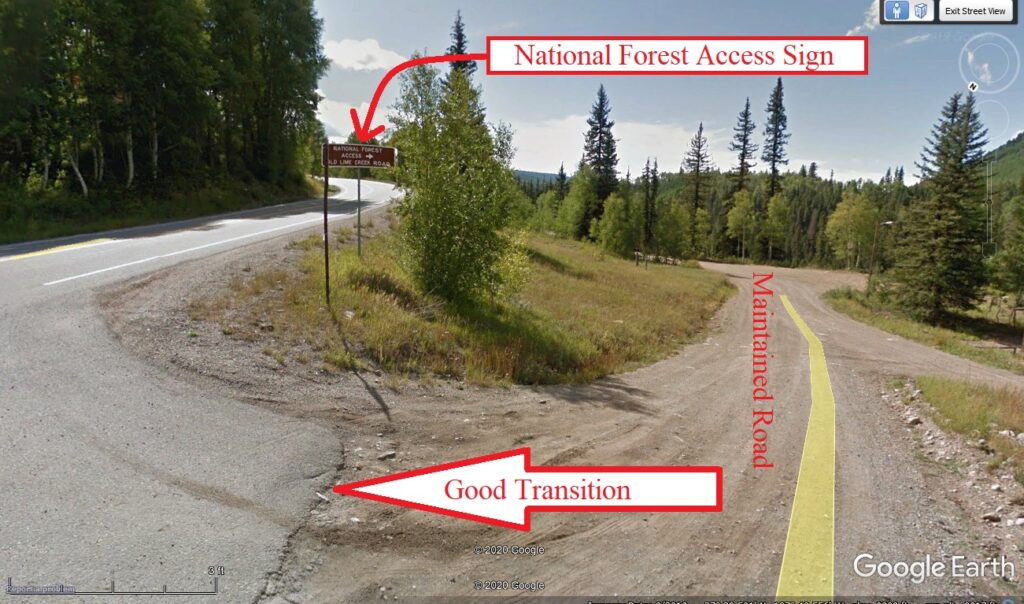
- Is there a gate? If there is a gate, is it signed as private (no trespassing, do not enter, etc) or is it there to keep cattle or wildlife on the appropriate side of the gate? If you have done your research and know that where you are headed is on public land, there will often be a sign confirming the government land agency that has jurisdiction.
- What are the conditions where the asphalt transitions to dirt/gravel? Is there a swale, ditch, or curb that might prove difficult to navigate with my RV?
- Looking “down” the back road, does brush encroach along the edge or low limbs that might damage my RV?

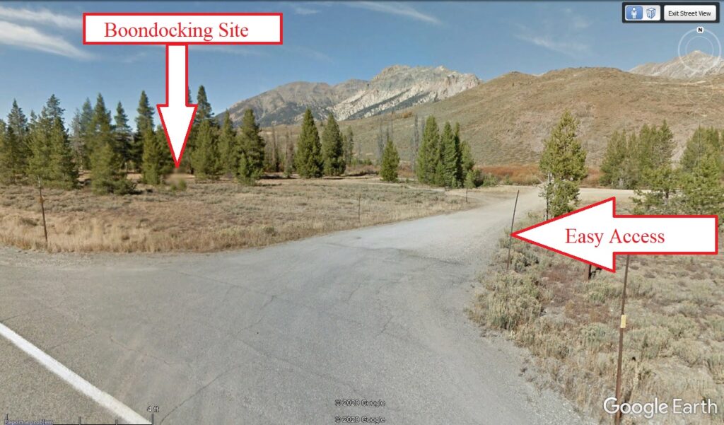
Easy access
- Does the road receive regular maintenance (grading/resurfacing with gravel)? Signs that it does include ridges along the edge where a road grader blade has passed. Or does the road have a crown of loose rock or low growing vegetation down the middle that indicates it hasn’t seen the blade of a road grader for years?
- Can I see other RVs parked down the road that can provide me with information on the size and type of other RVs that gained access via the road? Some sites are so close to the main road that I can view the entire path from asphalt to campsite.
- Is there any signage that will provide additional information such as “Camping Prohibited”, “Dispersed Camping Allowed”, “Private Property”, “Not recommended for RVs”, etc?
While Google Earth street view doesn’t supply as much useful information as satellite view does, it will likely give you enough information to help you make an informed decision whether or not to drive down the back road with the RV. Simplifying traveling to a boondocking site, just another adventure in RVing!

According to its website, there are about 350,000 Forest Service roads open to the public with 4WD capability. Are there other specific RV characteristics/requirements beyond 4WD that I need to be aware of?
The problem is that Google earth is not necessarily updated often enough to be useful. I know this by viewing my own house and seeing the view with a boat I had sold a year ago!
This is a good idea, but people shouldn’t expect that Street View images will be available for all locations. Even many rural highways are not covered, and back roads are even less likely. Check… but be prepared to not find Street View available.
Where it is available, Street View actually provides more information of some types than satellite view, such as the signs and road surface issues discussed in the article.
Unlike satellite view, Street View shows the date on which the image was taken. This is worth checking, as it may be well out of date and so to be used with caution.
What a great tool!! Thanks for the article.
The one problem with google earth is some of their views are five to ten years old. So at that age some of the views are useless. DO NOT rely on Google Earth’s view. You may be sorry.